Route Napoleón or Valcarlos?

Route Napoleón or Valcarlos?

Bottom line: Both routes run from Saint Jean Pied de Port to Roncesvalles on the first day of the Camino Francés. Route Napoléon climbs to 1,450m at the Col de Lepoeder — harder, more scenic, and the one most pilgrims choose. Valcarlos follows the valley to 950m — gentler, more road walking, and splittable into two days. Route Napoléon is our recommendation when weather and fitness allow, but it is closed by local authorities from November to the end of March for safety reasons, when Valcarlos becomes the only option.

The first stage: Saint Jean Pied de Port to Roncesvalles

The first section of the Camino Francés across the Pyrenees begins in the pretty Basque town of Saint Jean Pied de Port, in France, and finishes in Pamplona, famous for the San Fermín running of the bulls.

The first walking day, from Saint Jean Pied de Port to Roncesvalles (950m), is probably the most challenging of the entire route — and you have two ways to do it. If you are still deciding where to begin, our guide to the best starting points for the Camino Francés puts this stage in context.

Route Napoléon vs Valcarlos at a glance

Route NapoléonValcarlos
Highest pointCol de Lepoeder, 1,450mRoncesvalles, 950m
Distance~25km~25km
TerrainMainly tracks and small country roadsMore road, fewer tracks
Profile20km constant ascent, 5km descentGradual, constant ascent
Can be split?NoYes — overnight in Valcarlos
Open all year?No — closed Nov–end of MarchYes
Best forMountain views, experienced walkersWinter, gentler pace, shorter days

Route Napoléon: the mountain crossing

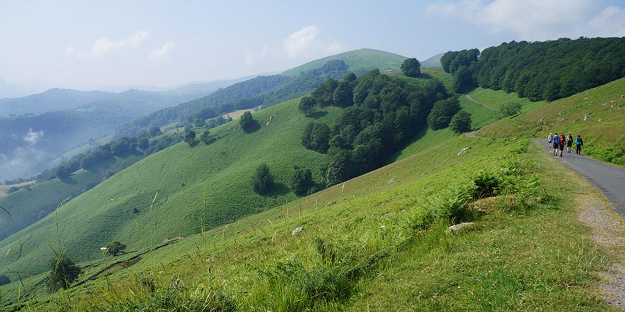
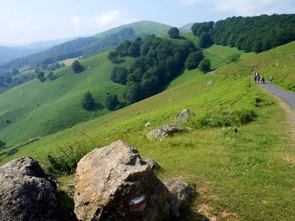
Route Napoléon takes you high into the Pyrenees, climbing steadily for around 20km to the Col de Lepoeder at 1,450m before a 5km descent into Roncesvalles. It is the more strenuous of the two for obvious reasons, and also by far the more popular — pilgrims consistently say the mountain views are worth the effort. The trail follows mainly tracks and small country roads.

We recommend this route, weather and fitness permitting. For a wider view of what the route asks of you, see how difficult the Camino Francés is.

Valcarlos: the valley route

The Valcarlos route runs down in the valley through the town of Valcarlos. The ascent is still constant, but far less dramatic, topping out at Roncesvalles itself (950m). You will walk more road and fewer tracks than on Route Napoléon.

Its practical advantage: you can split the 25km into two shorter days by staying overnight in Valcarlos — useful if you are easing into the Camino or walking with a mixed-ability group.

Beyond Roncesvalles the route drops into Zubiri, home to the Puente de la Rabia and its curious legend, before reaching Pamplona. You can also watch our video of the walk from Saint Jean Pied de Port to Pamplona to see the terrain for yourself.

Winter closure: an important note

Since 2015, local authorities close the mountain route from Saint Jean Pied de Port to Roncesvalles from November until the end of March for safety reasons, and this can be extended depending on the weather. Pilgrims walking this section of the Camino Francés during those months will have to take the Valcarlos route.

Walk it with us

Have more Camino de Santiago questions, or ready to book your trip? Contact the CaminoWays.com travel specialists.

FAQ

Which route is harder, Route Napoléon or Valcarlos?

Route Napoléon is harder. It climbs 500m higher, to the Col de Lepoeder at 1,450m, with roughly 20km of continuous ascent followed by a 5km descent. Valcarlos ascends more gradually to 950m at Roncesvalles.

Which route do most pilgrims take?

Route Napoléon is the more popular choice, chosen for its Pyrenean mountain views.

Is Route Napoléon closed in winter?

Yes. Local authorities close it from November until the end of March for safety reasons, and the closure can be extended in poor weather. Valcarlos is open year-round.

How long is the walk from Saint Jean Pied de Port to Roncesvalles?

Around 25km on either route. It is usually the most demanding day of the whole Camino Francés. For the full picture, see how far the Camino is from Saint Jean to Santiago.

Can I split the first day into two?

Yes, on the Valcarlos route — you can stay overnight in Valcarlos and walk two shorter days. Route Napoléon is a single stage.

What is the highest point on each route?

Route Napoléon reaches the Col de Lepoeder at 1,450m. On the Valcarlos route, the highest point is Roncesvalles at 950m.

Which route should I choose?

If the weather is good, you are reasonably fit, and you are walking between April and October, take Route Napoléon. Choose Valcarlos in winter, in bad weather, or if you would rather walk two gentler days.

Where can I see this stage on a map?

Our Camino Francés map shows the full route, including the Pyrenean crossing and each stage on to Santiago.

contact-us-button-2017

Join Our Newsletter

Plan your CaminoPlan
Scroll to Top